|
|
Order by Related
- New Release
- Rate
Results in Title For geo coordinates
 | Geo World is a handy application for finding out detailed information about any country in the world. .. |
|
| RCounter Geo is a system for gathering and reviewing statistics, analysis of web-site attendance (as well as separate web-pages).
RCounter is an easy-to-implement professional web site tracking and analysis service. ..
|
|
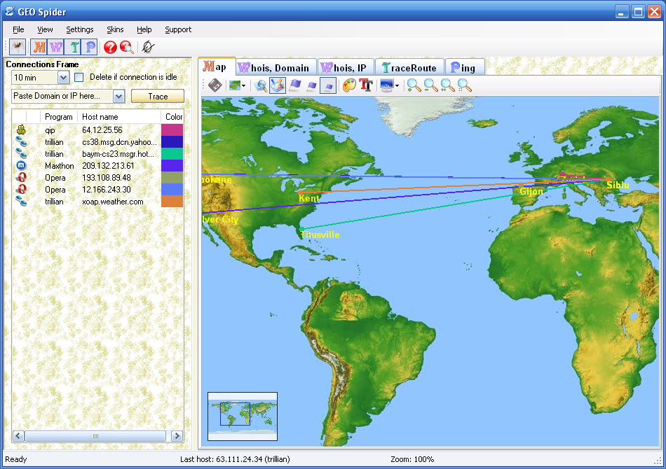 | GEO Spider helps you to trace, identify and monitor your network activity on world map. Whois reports give to you more info about site, host, domain, ip address... .. |
|
 | Easy Chart 3D GEO is easy to use wizard-like graphical reporting tool for effortless generation of complex business, management, financial and ad-hoc geographical pie charts (cylinder and cube shapes also available) of professional quality. Charts are generated on a top of a 3D geographical maps. Geographical Maps that are available: USA by states, USA states by counties, Europe by countries, Germany, Italy, United Kingdom, Spain, France, Austria, Australia, custom made maps and other on-demand maps.
Direct connection to Microsoft SQL Server, MS Access, Oracle and other databases (via ODBC) is available to fetch data from business systems (no place for human errors and very fast). Also, data can be Cut and Pasted from Microsoft Excel worksheets.
Graphical charts may be sent directly via email ('fire-and-forget' no-garbage technology) or saved to disk for later use in HTML WEB pages, business reports, marketing presentations or business meetings (suitable for LCD projectors and Screen Wall presentations).
Reports can be generated for English, German, Spanish, Italian, Chinese, Japanese or any other language (Unicode compatible).
Different output formats supported: 1) for image generation JPG (JPEG), TIFF, BMP, GIF, WMF and PNG format, 2) for animated reports AVI (Audio-Video Interchange) format so you can virtually 'fly over' your business regions and 3) smartCh@rt format (standalone interactive graphical business report format that does not require viewer on client side). SmartCh@rt is especially good for human communication inside organizations and companies because it promotes Paperless Office philosophy. Supports image resolutions from 200x200 to 2000x2000 pixels and 24-bit color depth. DirectX or OpenGL is NOT required.
For shorter transfer times and smaller memory footprint, ZIP compression option is available.
24-hour support team. Fast custom chart design team.
Get more info about program at GeoBrush's International site www.geobrush.com ..
|
|
 | Use this unique e-marketing tool to visually represent geo-targeting data obtained from web server log analysis. See your visitors on the world map. Optimize website costs and bring more customers to your web enterprise! .. |
|
| Today, businesses are going online. Effective web marketing starts with thorough analysis of your potential customers browsing habits, web site effectiveness monitoring and geo-targeting.
Web server raw logs offer a lot of valuable marketing information. The only question is: what tool do we use to extract this precious data from meaningless lines of alphanumerical characters, which are actually web server logs. The right tool makes the difference between a lame e-business development strategy and a winning one!
Introducing Geo Log Analyzer by Altstone Software, the unique web server logs analyzer capable of representing geographical stats on your website visitors in self-explanatory graphical world map view!
Geo Log Analyzer is a specialized net-marketer ..
|
|
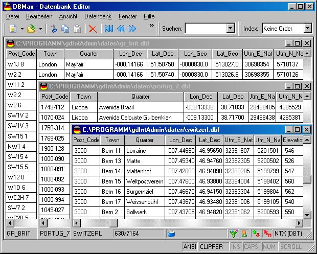 | Geodata of the European and International countries with municipalities and postal codes. Georeferences as UTM- and geographic coordinates (WGS84, ETRS89). Suitable for branch searches, periphery searches and distance computations. These countries are available: Albania, Andorra, Belgium, Bosnia, Bulgaria, Denmark, Canada, Estonia, Finland, France, Georgia, Gibraltar, Greece, Great Britain, Ireland, Italy, Ex Yugoslavia, Canada, Croatia, Latvia, Liechtenstein, Lithuania, Luxembourg, Malta, Macedonia, Mexico, Moldavia, Monaco, Netherlands, Norway, Austria, Poland, Portugal, Romania, Russia, San Marino, Sweden, Switzerland, Slovakia, Slovenia, Spain, Czech Republic, Turkey, Ukraine, Hungary, Vatican, White Russia, USA, Cyprus and many more. The download contains a test composition of data cutouts of a lot of countries in different file formates and the exact data description. Here the available data fields of the tables are specified: National identification of the country, local identification for the place within the country, postal zip code, place name, local part name, local administrative identification (municipality key), geographical longitude and geographical latitude in degree and deg/min/sec notation, UTM easting and UTM northing on the natural and an uniformal meridian strip, local size (categories), local meaning (categories), 4 hierarchical administrative units, which are superordinate the place. .. |
|
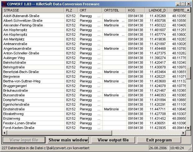
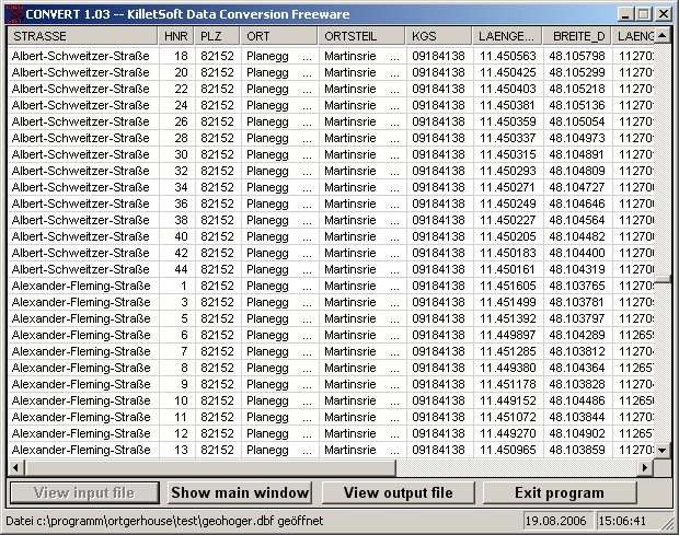
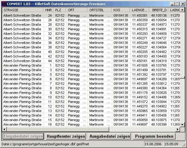
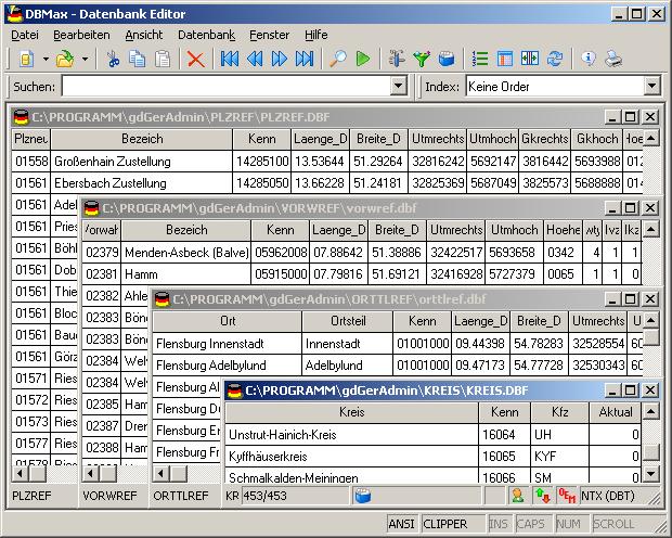
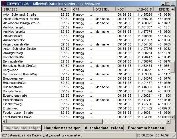
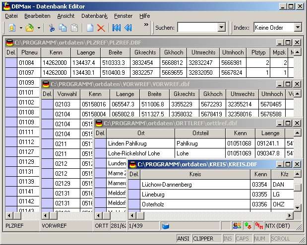 | Geodata of the Federal Republic Germany with municipalities, postal codes, telefone preselections. Suitable for branch searches, periphery searches and distance computations. Georeferences as Gauss Krueger, UTM and Geographic Coordinates and also Ground Level Elevations. ORTREF: 12.500 geocoded cities and municipalities. ORTGEM: Allocation of 12.500 cities and municipalities to the localities. ORTTLREF: 63.000 geocoded local parts. ORTTLGEM: Allocation of 63.000 local parts to the localities. PLZREF: 32.000 geocoded postal zip codes of the zip areas and p.o. box areas. PLZGEM: Allocation of 32.000 postal zip codes to the localities. VORWREF: 20,500 geocoded telephone local area preselections. VORWGEM: Allocation of 20.500 telephone local area preselections to the localities. KREIS: 450 Local districts. REGBEZ: Governmental districts. LAND: Counties of the German Federal Republic. The download contains a test composition of the data of 5 local districts and the exact data description. A freeware conversion program CONVERT for producing of different data formats can be downloaded from the site http://www.killetsoft.de/p_cona_e.htm. Here the data fields of the table ORTREF are specified as example: Place name, municipality key, geographical longitude and geographical latitude in degree notation, geographical longitude and geographical latitude in degree / minute / secund notation, Gauss Krueger easting, Gauss Krueger northing, UTM easting, UTM northing, elevation over sea level, new postal zip code (significant digits), old postal zip code, number of inhabitants, No. of the telephone directory, No. of the topographic card 1:25000, UNLOCODE, type of place, date of record change. .. |
|
 | For the area of the Federal Republic of Germany more than 2,7 million street coordinates with a coverage of 100% are available. The geo data offered here are in high-precision quality and are present in different coordinate and reference systems. Street coordinates or also called street section coordinates are meaning the summary of several postal house addresses to an averaged position on street or street section basis. The street coordinates are to be used with applications, which are developed to assign street oriented address groups exact positions. Street-exact geo data are on the one hand less expensive than the high resolution house-exact geo data, on the other hand they are more exact than the economically priced administrative geo data. The possible field of application is very various. E.g. own address lists can be enriched with geo references and visualized on suitable map material. The application scope reaches from information systems over navigation services, geo marketing, telecommunications and UTMS based services up to Web applications and tasks of the power authorities and security services. Another point of interest can be the establishing relationships between data derived from different hierarchies and levels. For example, it could be desirable to know to which federal state, administrative district and city a building belongs to. The coordinates of the streets are present as geographic coordinates, UTM coordinates and Gauss-Krueger coordinates. Geographical coordinates in degree notation are particularly suitable well for searches with Google Earth. Here is as an example an Internet URL with coordinates from the "Geo Data German Streets", which can represent the location of Killet Software Ing.-GbR: "http://maps.google.com/maps?t=k&ll=51.397363,6.450883&spn=0.002,0.002". The first value behind the identifier "ll" (lat / lon) is the geographical latitude, then the geographical longitude follows. .. |
|
 | For many countries street coordinates are present with coverage degrees upto 100 percent. The geo data offered here are in high-precision quality and are present in different coordinate and reference systems. Street coordinates or also called street section coordinates are meaning the summary of several postal house addresses to an averaged position on street or street section basis. The street coordinates are to be used with applications, which are developed to assign street oriented address groups exact positions. The possible field of application is very various. So e.g. own address lists can be enriched with geo references and visualized on suitable map material. The application scope reaches from information systems over navigation services, geo marketing, telecommunications and UTMS based services up to Web applications and tasks of the power authorities and security services. Another point of interest can be the establishing relationships between data derived from different hierarchies and levels. For example, it could be desirable to know to which administrative or postal unit a street belongs to. The coordinates of the streets are present as geographic coordinates and UTM coordinates. Geographical coordinates in degree notation are particularly suitable well for searches with Google Earth. Here is as an example an Internet URL with coordinates from the "Geo Data International Streets", which can represent the location of Killet Software Ing.-GbR: "http://maps.google.com/maps?t=k&ll=51.397363,6.450883&spn=0.002,0.002". The first value behind the identifier "ll" (lat / lon) is the geographical latitude, then the geographical longitude follows. The shown URL can be inserted directly into the address field of the browser to represent a map cutout on the screen. Street-exact geo data are on the one hand less expensive than the high resolution house-exact geo data, on the other hand they are more exact than the economically priced administrative geo data. .. |
|
Results in Keywords For geo coordinates
 | transforms cartesian, spherical and cylindrical coordinates (5 languages).. |
|
| Calc3D is a calculator for vectors, matrices, complex numbers, quaternions and coordinates.
For objects like point, line, plane and sphere distances, intersections, volume, area of squeres, area of a triangle can be calculated.
(5 languages)..
|
|
| AllTrans can be used for world wide professional coordinate transformations between international and national coordinate systems with or without geodetic datum change. Transformations between State-Plane-Coordinates (NAD83, NAD27, Transverse Mercator, Lambert, Soldner-Cassini, Mercator, EOV, Krovak, LV95, Pulkovo-Gauss-Krueger, Gauss-Boaga,...), UTM-Coordinates, Geographical- and 3d-Cartesian-Coordinates.
Manual input and File-Import/Export (ASCII).
If the geodetic datum of Start- and Targetsystem is not identical there is a datum shift possible (3-Parameter-Molodenski or 7-Parameter-Bursa-Wolf).
AllTrans is available in English/German and there is also an Online-Help available.
For all countries there are predefined datum shifts to WGS84. For higher accuracies it is possible to calculate individual parameters using identical points. These parameters then can be stored to the database in AllTrans.
The calculation can be done with a Standard-L2-Adjustment or otherwise using an adjustment with reweighting. There is also an outlier test implemented.
With the Geoid-Modul the user can calculate orthometric heights from GPS-heights... |
|
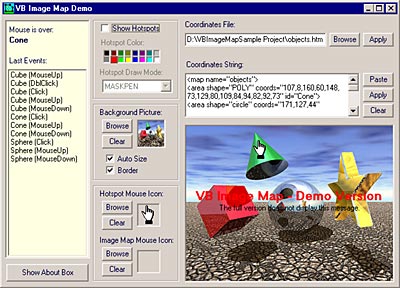 | The VB Image Map OCX allows you to display interactive images in your applications. Hotspots within your image can be defined that will react to various mouse events. It uses standard HTML syntax to define hotspot coordinates...
|
|
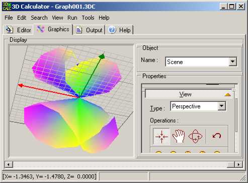
| MoNooN Grapher help that you plot the Mathematical Function Graphs. It can plot and display the following graphs. 2D Rectangular Coordinates Graph 2D Polar Coordinates Graph 3D Rectangular Coordinates Graph 3D Spherical Coordinates Graph 3D Cylindrical Coordinates Graph It includes Grapher 2DR, Grapher 2DP, Grapher 3DR, Grapher 3DS, and Grapher 3DC. .. |
|
 | A multipurpose software calculator, compute complex arithmetic expressions including matrices and user defined variables, Plot 2D 3D animated functions and is provided with a high level programming language.
MAIN FEATURES
o Support unlimited number of variable definitions.
o All calculations are made in extended real number format (19 to 20 significant digits).
o You are not limited by the size or the complexity of your arithmetic expressions.
o Matrix operations are supported and seamlessly integrated.
o There is no limit for the size of your matrices.
o Many scientific functions semantic are extended in order to be applied efficiently on matrices.
o Plot simultaneously unlimited number of functions.
o Support 2D/3D plotting including curves and surfaces.
o You can plot your function using rectangular, cylindrical, polar or spherical coordinates system.
o Parametric functions are supported in all coordinates systems.
o Color dimension is also supported in 2D/3D plotting.
o All coordinates systems components and color components (Red, Green and Blue) can be animated by specifying an animation parameter.
o Integrate a high level programming language.
o You can write and run your own programs under the same environment.
o You are not limited by the size or the amount of data needed by your programs...
|
|
 | FlashPoints is a tool for creating and managing points Groups (topographic points for example). FlashPoints allows you to : * import/export points coordinates from and to a file * create points and their attributes "Number", "Elevation.. |
|
 | Location spy enables you to obtain the location (GPS/GSM) of the target phone by sending an SMS.. |
|
 | TOPOWIN is a state-wide register of the German topographic cartographies and of localities with geo references in different coordinate systems. It also is a topographic information system... |
|
| Geodata International - World-wide database of countries with georeferenced towns, municipalities, postal codes and administrative units with WGS84 and UTM coordinates and elevations for geocoding, proximity search, navigation, distance calculation... |
|
Results in Description For geo coordinates
 | For the area of the Federal Republic of Germany more than 19 million house coordinates with a coverage of 100% are available. The geo data offered here are in high-precision quality and are present in different coordinate and reference systems. House Coordinates or also called Geo Coded Building Addresses are meaning the connection between the postal addresses of buildings and their accurate positions. The house coordinates are the basis for applications, which are developed to assign buildings exact positions. The possible field of application is very various. So e.g. own address lists can be enriched with geo references and visualized on suitable map material. The application scope reaches from information systems over navigation services, geo marketing, telecommunications and UTMS based services up to Web applications and tasks of the power authorities and security services. Another point of interest can be the establishing relationships between data derived from different hierarchies and levels. For example, it could be desirable to know to which federal state, administrative district and city a building belongs to. The coordinates of the buildings are present as geographic coordinates, UTM coordinates and Gauss Kruger coordinates. Geographical coordinates in degree notation are particularly suitable well for searches with Google Earth. Here is as an example an Internet URL with coordinates from the "Geo Data German Houses", which can represent the location of Killet Software Ing.-GbR point-exactly: "http://maps.google.com/maps?t=k&ll=51.397363,6.450883&spn=0.002,0.002". The first value behind the identifier "ll" (lat / lon) is the geographical latitude, then the geographical longitude follows. The shown URL can be inserted directly into the address field of the browser to represent a map cutout on the screen... |
|
 | For many countries house coordinates are present with coverage degrees upto 100 percent. The geo data offered here are in high-precision quality and are present in different coordinate and reference systems. House Coordinates or also called Geo Coded Building Addresses are meaning the connection between the postal addresses of buildings and their accurate positions. The house coordinates are the basis for applications, which are developed to assign buildings exact positions. The possible field of application is very various. So e.g. own address lists can be enriched with geo references and visualized on suitable map material. The application scope reaches from information systems over navigation services, geo marketing, telecommunications and UTMS based services up to Web applications and tasks of the power authorities and security services. Another point of interest can be the establishing relationships between data derived from different hierarchies and levels. For example, it could be desirable to know to which administrative or postal unit a building belongs to. The coordinates of the buildings are present as geographic coordinates and UTM coordinates. Geographical coordinates in degree notation are particularly suitable well for searches with Google Earth. Here is as an example an Internet URL with coordinates from the "Geo Data International Houses", which can represent the location of Killet Software Ing.-GbR point-exactly: "http://maps.google.com/maps?t=k&ll=51.397363,6.450883&spn=0.002,0.002". The first value behind the identifier "ll" (lat / lon) is the geographical latitude, then the geographical longitude follows. The shown URL can be inserted directly into the address field of the browser to represent a map cutout on the screen...
|
|
 | For many countries house coordinates are present with coverage degrees upto 100 percent. The geo data offered here are in high-precision quality and are present in different coordinate and reference systems. House Coordinates or also called Geo Coded Building Addresses are meaning the connection between the postal addresses of buildings and their accurate positions. The house coordinates are the basis for applications, which are developed to assign buildings exact positions. The possible field of application is very various. So e.g. own address lists can be enriched with geo references and visualized on suitable map material. The application scope reaches from information systems over navigation services, geo marketing, telecommunications and UTMS based services up to Web applications and tasks of the power authorities and security services. Another point of interest can be the establishing relationships between data derived from different hierarchies and levels. For example, it could be desirable to know to which administrative or postal unit a building belongs to. The coordinates of the buildings are present as geographic coordinates and UTM coordinates. Geographical coordinates in degree notation are particularly suitable well for searches with Google Earth. Here is as an example an Internet URL with coordinates from the "Geo Data International Houses", which can represent the location of Killet Software Ing.-GbR point-exactly: "http://maps.google.com/maps?t=k&ll=51.397363,6.450883&spn=0.002,0.002". The first value behind the identifier "ll" (lat / lon) is the geographical latitude, then the geographical longitude follows. The shown URL can be inserted directly into the address field of the browser to represent a map cutout on the screen... |
|
| MoNooN Grapher help that you plot the Mathematical Function Graphs. It can plot and display the following graphs. 2D Rectangular Coordinates Graph 2D Polar Coordinates Graph 3D Rectangular Coordinates Graph 3D Spherical Coordinates Graph 3D Cylindrical Coordinates Graph It includes Grapher 2DR, Grapher 2DP, Grapher 3DR, Grapher 3DS, and Grapher 3DC. ..
|
|
 | ORTWIN is a program for the state-wide inquiry of the localities in Germany. It finds postal zip codes, telephone pre selections, coordinates, it performs perimeter searches and distance calculations. The program determines municipal codes, local center points, car license codes, topographic maps and more. It arranges localities hierarchically into the structures federal country, administrative district, rural district, town, municipality, local quarter and domicile. In a radius around a place or around a postal code area covered localities and postal areas can be clearly represented by a comfortable perimeter search. They can also be arranged in a list, stored as a file and printed. For the local inquiries and perimeter searches a data base with more than 60.000 geo coded localities is available. The program represents local data, determined by local inquiries and perimeter searches, in graphic overviews and data lists. The program supports conversions between different coordinate systems and the distance calculation between the places. It calculates with Gauss Krueger coordinates and Geographic Coordinates referring to the Potsdam Datum (Bessel ellipsoid with central point Rauenberg). It also works with UTM coordinates, which refer to the datum ETRS89 (GRS80 / WGS84, geocentric). The functionality of the program is described in a detailed electronic manual. The program can be run on most common networks and it is possible to use Terminal Services on WINDOWS Servers. The client installations are done automatically... |
|
| Today, businesses are going online. Effective web marketing starts with thorough analysis of your potential customers browsing habits, web site effectiveness monitoring and geo-targeting.
Web server raw logs offer a lot of valuable marketing information. The only question is: what tool do we use to extract this precious data from meaningless lines of alphanumerical characters, which are actually web server logs. The right tool makes the difference between a lame e-business development strategy and a winning one!
Introducing Geo Log Analyzer by Altstone Software, the unique web server logs analyzer capable of representing geographical stats on your website visitors in self-explanatory graphical world map view!
Geo Log Analyzer is a specialized net-marketer..
|
|
| An all-in-one coordinate conversation and transformation program, available as Leisure-Edition ($55) for hobby and sports and Pro-Edition ($535) with 3-D transformations, additional options and implemented geoids. Coordinates may be entered via keyboard and file; EasyTrans supports geographic, UTM, isometric and geocentric coordinates and comes with all ellipsoids and projections used world-wide. .. |
|
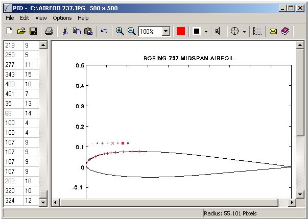 | Precision Image Digitizer - Trace & record the coordinates of your selected points in a JPG, GIF, or BMP. Point and click on the points in the image that you would like to record. The coordinates are displayed on the screen as you click them and they can then be exported to an ASCII text file, exported to an AutoCad DXF file, or printed... |
|
 | Calc 3D is a collection of mathematical tools for highschool and university. The calculator can do statistics, best fits, function plotting, integration. It handles vectors, matrices, complex numbers, coordinates, regular polygons and intersections. For objects ( like point, line, plane and sphere) distances and intersections are calculated. Cartesian, spherical and cylindrical coordinates can be transformed into each other. Carthesian plot, polar plot, parametric plot, best fit, fast fourier transformation, histogram, smooth,... .. |
|
 | Calc 3D is a collection of mathematical tools for highschool and university. The calculator can do statistics, best fits, function plotting, integration. It handles vectors, matrices, complex numbers, coordinates, regular polygons and intersections. For objects ( like point, line, plane and sphere) distances and intersections are calculated. Cartesian, spherical and cylindrical coordinates can be transformed into each other. Carthesian plot, polar plot, parametric plot, best fit, fast fourier transformation, histogram, smooth,..... |
|
Results in Tags For geo coordinates
| For many countries street coordinates are present with coverage degrees upto 100 percent. The geo data offered here are in high-precision quality and are present in different coordinate and reference systems. Street coordinates or also called street section coordinates are meaning the summary of several postal house addresses to an averaged position on street or street section basis. The street coordinates are to be used with applications, which are developed to assign street oriented address groups exact positions. The possible field of application is very various. So e.g. own address lists can be enriched with geo references and visualized on suitable map material. The application scope reaches from information systems over navigation services, geo marketing, telecommunications and UTMS based services up to Web applications and tasks of the power authorities and security services. Another point of interest can be the establishing relationships between data derived from different hierarchies and levels. For example, it could be desirable to know to which administrative or postal unit a street belongs to. The coordinates of the streets are present as geographic coordinates and UTM coordinates. Geographical coordinates in degree notation are particularly suitable well for searches with Google Earth. Here is as an example an Internet URL with coordinates from the "Geo Data International Streets", which can represent the location of Killet Software Ing.-GbR: "http://maps.google.com/maps?t=k&ll=51.397363,6.450883&spn=0.002,0.002". The first value behind the identifier "ll" (lat / lon) is the geographical latitude, then the geographical longitude follows. The shown URL can be inserted directly into the address field of the browser to represent a map cutout on the screen. Street-exact geo data are on the one hand less expensive than the high resolution house-exact geo data, on the other hand they are more exact than the economically priced administrative geo data... |
|
 | For many countries street coordinates are present with coverage degrees upto 100 percent. The geo data offered here are in high-precision quality and are present in different coordinate and reference systems. Street coordinates or also called street section coordinates are meaning the summary of several postal house addresses to an averaged position on street or street section basis. The street coordinates are to be used with applications, which are developed to assign street oriented address groups exact positions. The possible field of application is very various. So e.g. own address lists can be enriched with geo references and visualized on suitable map material. The application scope reaches from information systems over navigation services, geo marketing, telecommunications and UTMS based services up to Web applications and tasks of the power authorities and security services. Another point of interest can be the establishing relationships between data derived from different hierarchies and levels. For example, it could be desirable to know to which administrative or postal unit a street belongs to. The coordinates of the streets are present as geographic coordinates and UTM coordinates. Geographical coordinates in degree notation are particularly suitable well for searches with Google Earth. Here is as an example an Internet URL with coordinates from the "Geo Data International Streets", which can represent the location of Killet Software Ing.-GbR: "http://maps.google.com/maps?t=k&ll=51.397363,6.450883&spn=0.002,0.002". The first value behind the identifier "ll" (lat / lon) is the geographical latitude, then the geographical longitude follows. The shown URL can be inserted directly into the address field of the browser to represent a map cutout on the screen. Street-exact geo data are on the one hand less expensive than the high resolution house-exact geo data, on the other hand they are more exact than the economically priced administrative geo data...
|
|
| For the area of the Federal Republic of Germany more than 2,7 million street coordinates with a coverage of 100% are available. The geo data offered here are in high-precision quality and are present in different coordinate and reference systems. Street coordinates or also called street section coordinates are meaning the summary of several postal house addresses to an averaged position on street or street section basis. The street coordinates are to be used with applications, which are developed to assign street oriented address groups exact positions. Street-exact geo data are on the one hand less expensive than the high resolution house-exact geo data, on the other hand they are more exact than the economically priced administrative geo data. The possible field of application is very various. E.g. own address lists can be enriched with geo references and visualized on suitable map material. The application scope reaches from information systems over navigation services, geo marketing, telecommunications and UTMS based services up to Web applications and tasks of the power authorities and security services. Another point of interest can be the establishing relationships between data derived from different hierarchies and levels. For example, it could be desirable to know to which federal state, administrative district and city a building belongs to. The coordinates of the streets are present as geographic coordinates, UTM coordinates and Gauss-Krueger coordinates. Geographical coordinates in degree notation are particularly suitable well for searches with Google Earth. Here is as an example an Internet URL with coordinates from the "Geo Data German Streets", which can represent the location of Killet Software Ing.-GbR: "http://maps.google.com/maps?t=k&ll=51.397363,6.450883&spn=0.002,0.002". The first value behind the identifier "ll" (lat / lon) is the geographical latitude, then the geographical longitude follows... |
|
 | The database contain geodata of the Federal Republic of Germany with geo referenced towns, municipalities, town quarters, administrative units, postal codes, telephone preselections, nature areas, landscapes, climatic zones for proximity searches ec...
|
|
 | The database contain geodata of the Federal Republic of Germany with geo referenced towns, municipalities, town quarters, administrative units, postal codes, telephone preselections, nature areas, landscapes, climatic zones for proximity searches ec... |
|
| Geodata of the European and International countries with municipalities and postal codes. Georeferences as UTM- and geographic coordinates (WGS84, ETRS89). Suitable for branch searches, periphery searches and distance computations. These countries are available: Albania, Andorra, Belgium, Bosnia, Bulgaria, Denmark, Canada, Estonia, Finland, France, Georgia, Gibraltar, Greece, Great Britain, Ireland, Italy, Ex Yugoslavia, Canada, Croatia, Latvia, Liechtenstein, Lithuania, Luxembourg, Malta, Macedonia, Mexico, Moldavia, Monaco, Netherlands, Norway, Austria, Poland, Portugal, Romania, Russia, San Marino, Sweden, Switzerland, Slovakia, Slovenia, Spain, Czech Republic, Turkey, Ukraine, Hungary, Vatican, White Russia, USA, Cyprus and many more. The download contains a test composition of data cutouts of a lot of countries in different file formates and the exact data description. Here the available data fields of the tables are specified: National identification of the country, local identification for the place within the country, postal zip code, place name, local part name, local administrative identification (municipality key), geographical longitude and geographical latitude in degree and deg/min/sec notation, UTM easting and UTM northing on the natural and an uniformal meridian strip, local size (categories), local meaning (categories), 4 hierarchical administrative units, which are superordinate the place...
|
|
 | For the area of the Federal Republic of Germany more than 2,7 million street coordinates with a coverage of 100% are available. The geo data offered here are in high-precision quality and are present in different coordinate and reference systems. Street coordinates or also called street section coordinates are meaning the summary of several postal house addresses to an averaged position on street or street section basis. The streetd coordinates are to be used with applications, which are developed to assign street oriented address groups exact positions. Street-exact geo data are on the one hand less expensive than the high resolution house-exact geo data, on the other hand they are more exact than the economically priced administrative geo data. The possible field of application is very various. E.g. own address lists can be enriched with geo references and visualized on suitable map material. The application scope reaches from information systems over navigation services, geo marketing, telecommunications and UTMS based services up to Web applications and tasks of the power authorities and security services. Another point of interest can be the establishing relationships between data derived from different hierarchies and levels. For example, it could be desirable to know to which federal state, administrative district and city a building belongs to. The coordinates of the streets are present as geographic coordinates, UTM coordinates and Gauss-Krueger coordinates. Geographical coordinates in degree notation are particularly suitable well for searches with Google Earth. Here is as an example an Internet URL with coordinates from the "Geo Data German Streets", which can represent the location of Killet Software Ing.-GbR: "http://maps.google.com/maps?t=k&ll=51.397363,6.450883&spn=0.002,0.002". The first value behind the identifier "ll" (lat / lon) is the geographical latitude, then the geographical longitude follows... |
|
| Geodata International - World-wide database of countries with georeferenced towns, municipalities, postal codes and administrative units with WGS84 and UTM coordinates and elevations for geocoding, proximity search, navigation, distance calculation... |
|
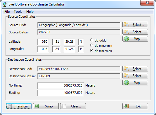 | Eye4Software Coordinate Calculator is a very easy to use tool to perform gps coordinate conversions. Supported projections: Transverse Mercator, Lambert Conformal Conic, UTM, Gauss Kruger, Stereographic, Albers Equal Area, Oblique Mercator and more... |
|
| World GeoDatabase - Latitude, Longitude, Altitude For Entire World. Create the GeoDatabase for the entire world. This program create the geographical location Latitude, Longitude, and Altitude (Elevation) for every city, village, region, state.. |
|
Related search : eo datacoordinates arestreet coordinates,international streets deutschgeodaten international streetsgeo datastreet coordinatesdata german,geo data germangerman streets englishdata german streetsgeo references,wind load zonesgeo references,wind load zOrder by Related
- New Release
- Rate
gps coordinates -
coordinates map -
texture coordinates -
cartesian coordinates -
finding coordinates -
|
|